
下载掌阅APP,畅读海量书库
立即打开


In Guilin, evidence of human activities can be traced back to 30,000 years ago.Chronologically, prehistory, pre-Qin, post-Qin to late Qing, the Republic of China, and post liberation are the five stages of Guilin’s history described in this chapter.
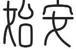
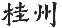
In its long history, the city’s name has changed multiple times, with the longest-used names being Shi’an and Lingui, and of and on during the Tang and Song dynasties “Guizhou”(桂州). It was not until 1372 that the name “Guilin” first referred to the location of modern Guilin.
The word “Guilin” was found first written in The Classic of Mountains and Seas i . In 214 BC, “Guilin” first appeared in “Guilin Jun” ii as a place name, but it does not refer to today’s Guilin City. After the town was made the capital of Guizhou in 1372, Guilin was commonly used in place of Guizhou in informal contexts during the Tang and Song Dynasty, and the name “Guilin” was used instead of Guizhou in poems and essays because the town had long been the capital of the primary administrative unit.
The cultural remains of the prehistoric sites in Guilin date from the late Paleolithic to the late Neolithic. The Baojiyan site from the Paleolithic Age is the oldest known cultural relic in the area. Stone tools have been unearthed at this cave site, which dates back more than 30,000 years. The Zengpiyan site dates back 12,000 to 7,000 years, and one of the most primitive shaped pottery vessels in China was unearthed there. In 2013, the Zengpiyan site was announced as one of China’s 150 major historical sites by the National Cultural Heritage Administration of China.
Before the Qin Dynasty, the Guilin region was settled by the Baiyue people. The “bai” of“Baiyue” (“one hundred” in Chinese) means “many,” which is an approximate number, whilst“yue” generally refers to the ancient ethnic groups in southeastern China, the influential tribes being Wuyue, Dong’ou, also known as Dongyue, Minyue, Nanyue, Xi’ou, also known as Xiyue, Luoyue, and Yangyue. Guilin was within the territory of the Xi’ou people.
214 BC
The first administration was set up after the Qin Dynasty’s (221–206 BC) third campaign against Baiyue in the area around Guilin. The modern city neighboured iii Guilin Jun (also as Guilin Commandery) iv , which is the origin of the modern name “Guilin”.
111 BC
During the Western Han Dynasty, Shi’an Xian was established; this could be regarded as the beginning of the city.
AD 256
During the reign of Emperor Wu of the Han Dynasty, Shi’an Xian became the capital of Shi’an Jun.
AD 507
The town was renamed Guizhou.
AD 634
Lingui County was established at the modern site of Guilin, under the jurisdiction of Guizhou.
AD 997
Guangnan West Lu v , predecessor of modern Guangxi, was established, with Guizhou as the capital.
AD 1133
Guizhou was renamed Jingjiang Fu vi (Chinese: 静江府) .
AD 1372
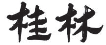
The town’s name was changed to Guilin Prefecture (Chinese:桂林府). This was the first time the town was o ficially named Guilin.
AD 1921
Guilin became one of the headquarters of the Northern Expeditionary Army led by Sun Yat-sen. In 1940, Guilin City was established. Guilin was the provincial capital of Guangxi before 1912 and again from 1936 to 1949. (The capital was temporarily moved to Nanning in 1912, and then back to Guilin in 1936.)
AD 1950
The provincial capital of Guangxi was moved from Guilin to Nanning.
i The Classic of Mountains and Seas , also known as Shan Hai Jing , is a Chinese classic text and a compilation of ancient geography, history, mythology, astronomy, beasts,plants, medicine, religion, and the history of anthropology, ethnology, oceanography and technology geography. It is commonly held that the first editor of the book was Liu Xiu(Chinese:刘秀) from the Western Han (202 BC-8 AD). As late as in the Tang and Song dynasties, scholars took the book as a documentary. When it comes to the Ming and Qing dynasties, the book was read as a narrative. The book now is taken as the “Encyclopedia of Ancient Times (of China)” by anthropologists.
ii It was during the Qin Dynasty that the system of two-tier administrative divisions was first officially formed, after the long evolution starting from the Spring and Autumn period. The two-tier administrative system was continuously used until the three-tier administrative divisions were developed in the Tang Dynasty. In the older administrative divisions, Jun was the primary level whilst xian the secondary, which was the opposite of Pre-Qin era.
iii There are some that claim that modern Guilin was within Guilin Jun when Guilin Jun was set up in 214 BC.
iv In his thesis Research on the Origin of Guilin , Qi Zhaojin (Chinese: 漆招进, 2013) claims that after the setting up of Guilin Jun, modern Guilin was not administered by Guilin Jun but rather neighboured it, which is quite dif erent from the commonly accepted theory.
v Lu (Chinese:路) is a traditional Chinese administrative division, initiated in the Song Dynasty as the primary level of administration. Lu follows the geographical division principle of Dao in the Tang Dynasty.
vi Fu (Chinese: 府) is a traditional Chinese administrative division, translated variously as commandery, prefecture, urban prefecture, or city. They were first instituted as a regular form of administrative division in China’s Tang Empire. Fu is at the same level as Zhou, but its status is slightly higher than that of the state. From the Tang Dynasty onwards, during the Tang and Song dynasties, the national capital, the secondary capital, the place where the emperor was born, lived and toured, as well as the important prefectures, were changed to Fu.
According to research, the first city built within the site of modern Guilin was in the Han Dynasty, and the city did not have a moat at that time. In the Tang Dynasty, during his term of service as Dudu (Commander-in-Chief) of Guizhou from 709 to 714, Wang Jun encouraged farming. During this period, Lingpo, a dam for farmland irrigation, was constructed.
In the Tang Dynasty, there were natural ponds scattered and streams flowing along the land of the city. A city moat was dug by extending and connecting the waters. Ronghu Lake, also known as Banyan Lake, and Shanhu Lake or Fir Lake, were both man-made lakes dredged to the south of the city in the Tang Dynasty. These two lakes, along with Haotang Lake to the west, formed the moat of the city.
Xihu Lake, another dredged body of water, linked up with the Yangjiang River, Ronghu Lake and Shanhu Lake, to form an unbroken water system.
王公祖道来帅是邦。念郡庠湫隘,风教未敷,乃辟而广之,诱进学者。又采堪舆家之说,洫子癸之流,以注辛戌,环城有水,如血脉之荣一身,遂闻之朝。
宋·张仲宇:《桂林盛事记》
In the Northern Song Dynasty, Wang Zudao (1039—1108), the Zhizhou, Commander-in Chief, of Guizhou believed: according to Feng Shui, water is to the ground as blood is to the human body. If the water was blocked, the Feng Shui would be ruined just the same as sickness is caused by poor blood flow. Mountains outnumbered bodies of water in Guizhou, and this needed to be compensated for with artificial waterways. In 1104, Wang Zudao conducted the extension of Lingpo to introduce the water of the Lijiang River into Xihu Lake from the north,hence connecting the Lijiang River and the Yangjiang River (now the Taohua River) to the west of the city. When the Yangjiang River poured into the Lijiang River to the south at the foot of Elephant Hill, a water ring around the city was formed.
The image of “water embracing the city” was seen from then on. There were three water rings around the city.
● To the east (from west to east): the Lijiang River, the Xiaodong River, and the Lingjian River
● To the west (from west to east): the Taohua River, West Lake, Xihaotang (now Guihu Lake), Qingtang and Fanglian Pond
● To the south (from south to north): the Taohua River and Yangtang (now Rong and Shanhu)
● To the north (from north to south): Chaozong Canal, Tiefo Pond, and a ditch without a specific name, approximately located at today’s Lequn Road, Xihua Road to Donghua Road
The rivers, canals, and lakes connected with each other to form an intricately intertwined waterway. It started from the water of the Lijiang River, flowed into Chaozong Canal, and ended with the Taohua River flowing into the Lijiang River to the south of the city.
It was believed the fresh water system nurtured the spiritual world, and that outstanding scholars would be cultivated in such an environment. The following commanders, Fan Chengda and Fang Xinru, conducted the re-dredging of the water system in 1174 and from 1208 to 1224 respectively. In the Song Dynasty, the water system functioned as a tour sightseeing attraction more than as a moat.
After the Song Dynasty, the waters were narrowed and polluted, and rivers and lakes were cut off. In the Ming Dynasty, during his visit to Guilin, without seeing the boundless water boasted of in earlier writings, Xu Xiake (1587—1641) expressed his melancholy in his travelogue book Xu Xiake’s Travels .
The first stage of Two Rivers and Four Lakes was finished, and the scenic spot was opened to tourists in 2002. This first stage of restoration followed the route of the middle ring of the water system in the Song Dynasty. The second stage of the project, which aims to restore the outer ring of the water system, was started in 2009.